Thursday Feb 18
We left Nettle Island at 8:00 continuing down the Indian River and passed through several towns including Fort Pierce, Vero Beach and Indian Beach. We saw a new way of advertising- just anchor your boat in the middle of the channel. We also saw another Pirate ship.
 and this Canadian sailboat.
 We ended up anchoring near the Melbourne bridge at 4:00, after going 63.5 miles.
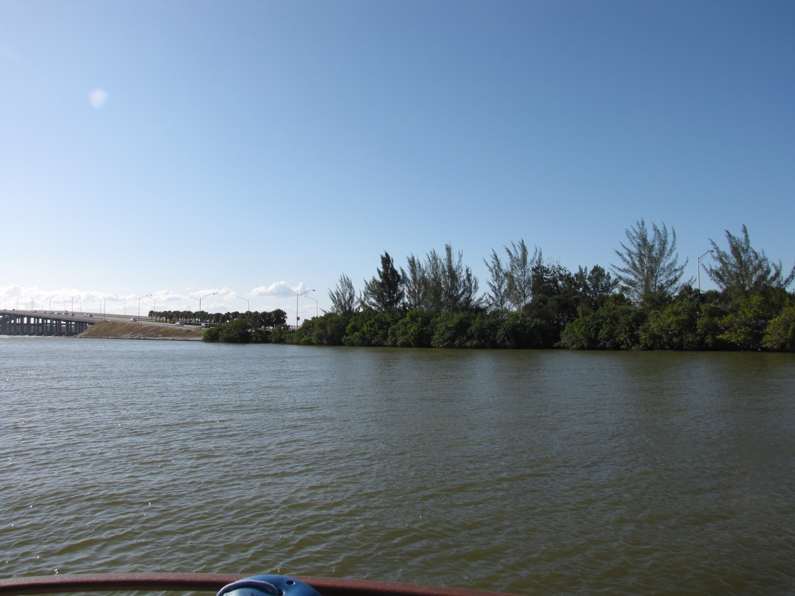 Another Canadian boat ended up anchoring near us- their boat name was “just faking it”, Andy talked to them on the VHF radio.
Friday Feb 19
With the winds blowing through the night, we found that our anchor had dragged somewhat- so the Admiral stayed up from about 3 a.m. on to ensure we didn’t get too near to the shore or other boats. At 7:00, we departed Melbourne and continued northward, we passed through Sebastian, Eau Gallie, Palm Shores, and Cocoa, Titusville. We saw the Kennedy Space Centre and launch pad from a distance as they are located on the Banana River, which is parallel to the Indian River and closer to the Atlantic. We continued on the Indian River entering the Haulover Canal at mile 869 and into the Mosquito Lagoon—it must be too cold for mosquitoes- cause we didn’t have an issue with them yet. We ended up at a free dock in New Smyrna Beach at mile 846. We met some other boaters at the dock, Terrapin and Catalina 315 that gave us some tips about places to stay farther up north. Feb 20
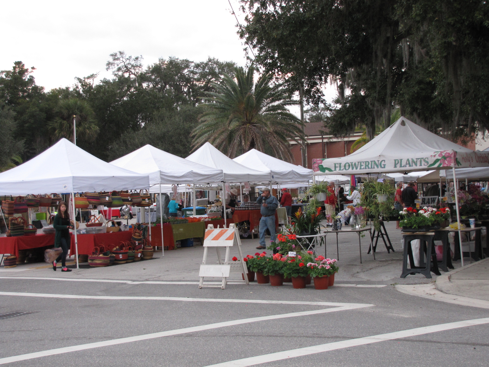 There was a farmer’s market nearby that I wanted to check out prior to leaving the dock. I bought some baking, fresh beets and some hot sauce. We departed New Smyrna at 7 50, and continued North on the Indian River. After Ponce de Leon inlet, the ICW becomes the Halifax River. Here’s the lighthouse:
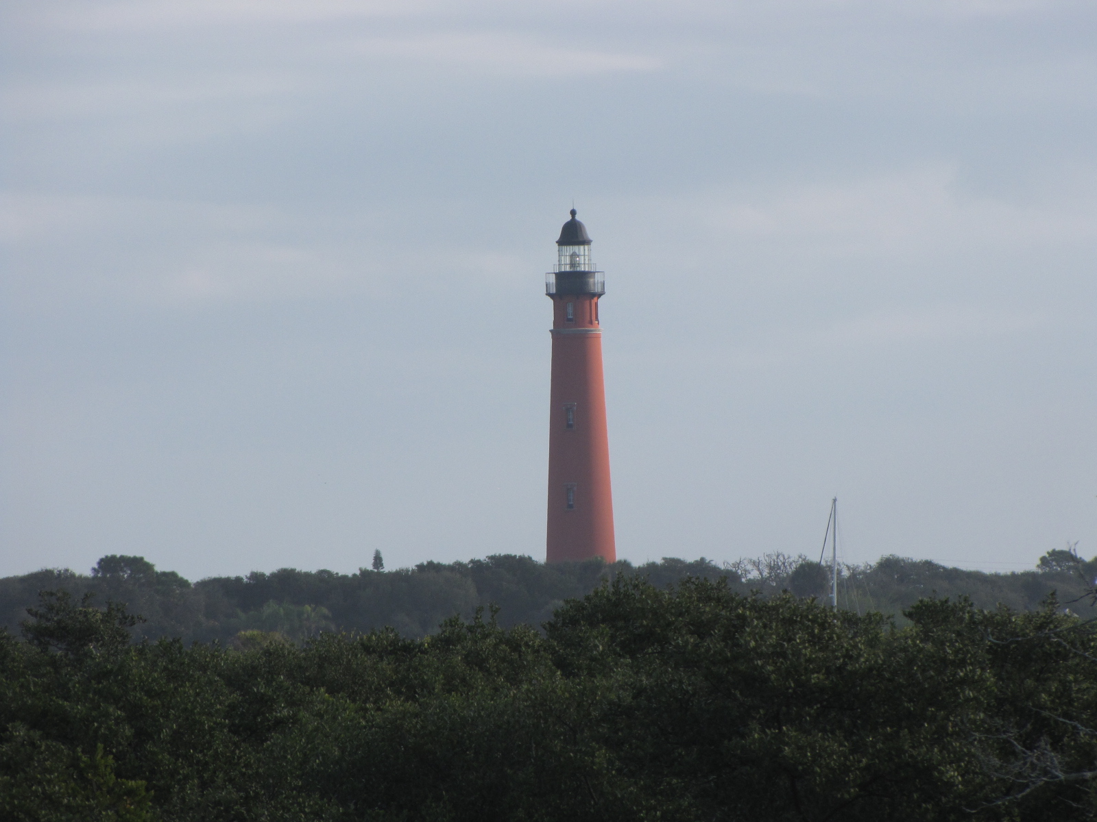 Prior to reaching Daytona Beach we went through a small community called Wilbur by the Sea, we reached Dayton Beach around 9:45. There was lots of boats on the river, and at the marinas we passed by- I wondered if maybe this was because of the Daytona 500 race. Andy said this pillar with the 2 on it is part of the racetrack.
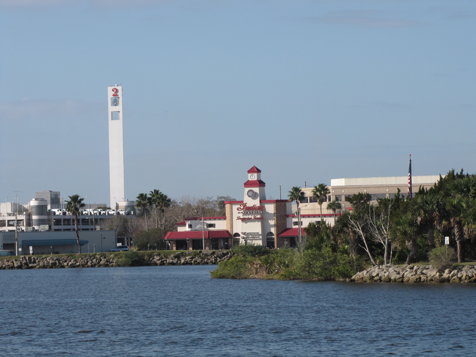 We also saw jets- likely the Blue Devils, fly in formations. We passed through a number of beach communities and Palm Coast, here the name of the ICW body of water became the Matanzas River. We continued northward through Marineland, Summer Haven, Crescent Beach, and reached St. Augustine around 15:00.
 After going through the Bridge of Lions, we overtook Catalina 315, a sailboat, which had left New Smyrna several hours before us. We were now traveling on the Tolomato River.
 Since it was a nice day with very little wind, we decided to go another 25 miles north and anchor out near Pine Island at 4:15.
 Feb 21
We weighed anchor at 7:20 and continued on our journey, it was another relatively calm day so we had hoped that we would get out of the state of Florida. We traveled along the Tolomato river which turned into San Pablo creek at Isle of Palms, we passed through Jacksonville and Mayport, which is near the inlet for the St. Johns River. Throughout the day our speed changed from 7.2 to 11.3 depending on where we were and the tidal currents caused by the many inlets we passed. At Mayport we entered Sisters Creek and followed it for 10 miles until we came to the Nassau Sound inlet and the South Amelia river. By 12:30 we had reached Fernandina Beach and the St. Mary’s Entrance, and we were ready to say good bye to Florida. Shortly after getting into Georgian waters, we heard on the VHF radio that there was a war ship entering the harbor and all boats had to give way and 500 yards of clearance. We were hailed by the security vessel with blue lights flashing and told we would be escorted out of the area.
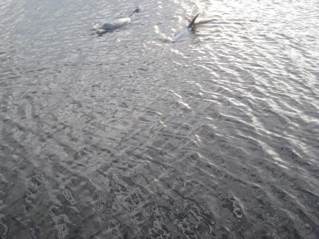
 Luckily we were close to the marker leading us away from Kings Bay Naval base. The warship was actually a nuclear submarine that you can see peaking out of the water in the centre of this picture.
 The captain says “depending on your perspective- we were either chased by a nuclear sub or led it to it’s home base” . We went another 10 miles north and ended up anchoring in Shellbine Creek at 3:00, at low tide in 8.4 feet of water, several hours later when high tide hit we were in 15.8 feet of water. The landscape looks quite different depending on how much water is around. At our anchorage we were visited by a pod of dolphins, Andy counted at least 11 that were happily swimming around and snorting.
 During the night the boat swung around as the tide went out and came in again.
Feb 22
When we left the anchorage at 8:45 it was high tide and we were at 16.3 feet of water. We traveled the 20 plus miles to Brunswick Landing Marina passing through St Andrew Sound inlet, where I saw this lighthouse on a cliff. We then took the Jekyll Creek and entered St.Simons Sound inlet , where there was quite a current and progress was slow. On our approach to Brunswick we went under this bridge, which has a 185 ft clearance.
 We arrived at the Marina at 11:30 and tied up. Once we were checked in we spent the next 2 hours scrubbing down the outside of the boat as there was salt everywhere. Plan for the remainder of the day is to go to the clubhouse at 5:00 for a free drink and then to a Thai restaurant for supper.
